|
|
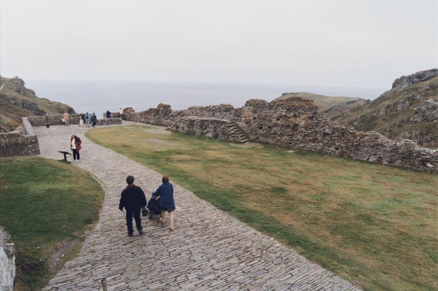
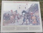
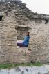
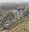
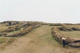
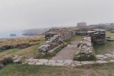
 The
Mainland Courtyards and the narrow passage leading
to the castle's entrance. This
was the outermost part of the medieval castle
built for Earl Richard of Cornwall. The
Mainland Courtyards and the narrow passage leading
to the castle's entrance. This
was the outermost part of the medieval castle
built for Earl Richard of Cornwall.
|
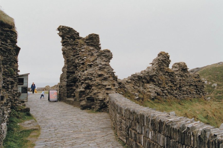
 In
medieval times, the only way to the castle was
along this narrow approach passage flanked by the
crag on the left and a high wall on the right. In
the event of an attack, this passage formed an
easy killing ground for defenders on top of the
battlemented gate tower. In
medieval times, the only way to the castle was
along this narrow approach passage flanked by the
crag on the left and a high wall on the right. In
the event of an attack, this passage formed an
easy killing ground for defenders on top of the
battlemented gate tower.
|
|
|
|
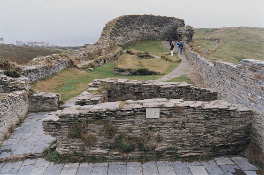
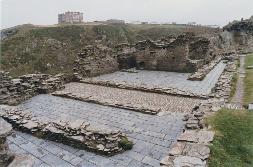
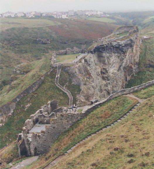
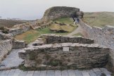
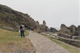
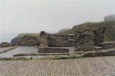
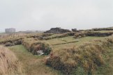
 The
Lower Mainland Courtyard. To the right of
the ruined gate tower is the high crag of rock which
allowed defenders to control the only safe
approach to their home. The
Lower Mainland Courtyard. To the right of
the ruined gate tower is the high crag of rock which
allowed defenders to control the only safe
approach to their home.
|
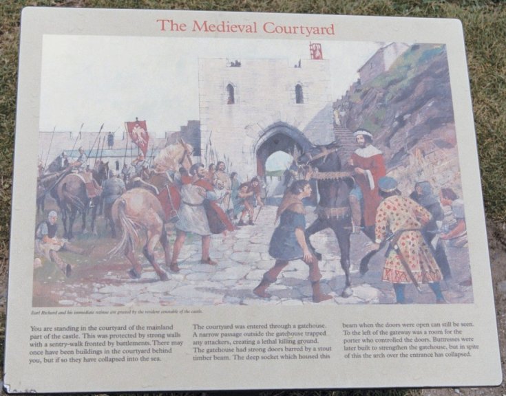
 Reconstruction
drawing by Ivan Lapper of the gateway and Lower Mainland Courtyard. Reconstruction
drawing by Ivan Lapper of the gateway and Lower Mainland Courtyard.
|
|
|
|
 The
Lower Mainland Courtyard as seen from the Upper
Mainland Courtyard. In the Middle
Ages, it was
bigger - almost a quarter of it has collapsed into
the sea. It was also more closed-in with high
battlemented walls on all four sides. The
Lower Mainland Courtyard as seen from the Upper
Mainland Courtyard. In the Middle
Ages, it was
bigger - almost a quarter of it has collapsed into
the sea. It was also more closed-in with high
battlemented walls on all four sides.
|
|
|
|
|
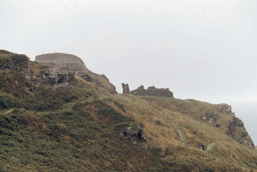
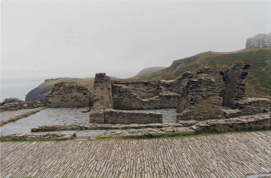
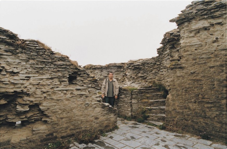
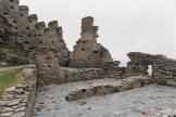
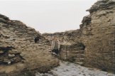
 The
southern portion of the Upper Mainland Courtyard
located on the high crag. The group of
stone-floored rooms (foreground) were built in the
latter Middle Ages. The lower grass-topped walls
could be the remains of buildings from a time
before either of the present courtyard walls were
built, because of their quite different alignment.
They may even have been a part of the Dark Age
stronghold, re-used when the castle was
built. The
southern portion of the Upper Mainland Courtyard
located on the high crag. The group of
stone-floored rooms (foreground) were built in the
latter Middle Ages. The lower grass-topped walls
could be the remains of buildings from a time
before either of the present courtyard walls were
built, because of their quite different alignment.
They may even have been a part of the Dark Age
stronghold, re-used when the castle was
built.
|
 View
of the upper Mainland Courtyard looking north.
Like the lower courtyard, this courtyard was
once much larger. Perhaps as much as half of the
courtyard has collapsed into the sea. View
of the upper Mainland Courtyard looking north.
Like the lower courtyard, this courtyard was
once much larger. Perhaps as much as half of the
courtyard has collapsed into the sea.
|
|
|
|
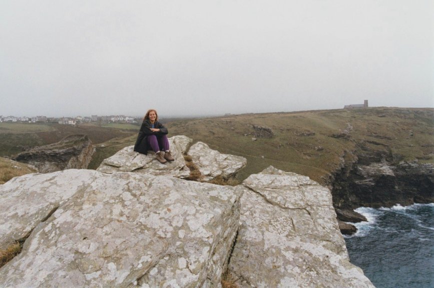
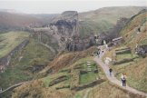
 View
of the Mainland Courtyards and the bridge as seen
from the south. View
of the Mainland Courtyards and the bridge as seen
from the south.
|
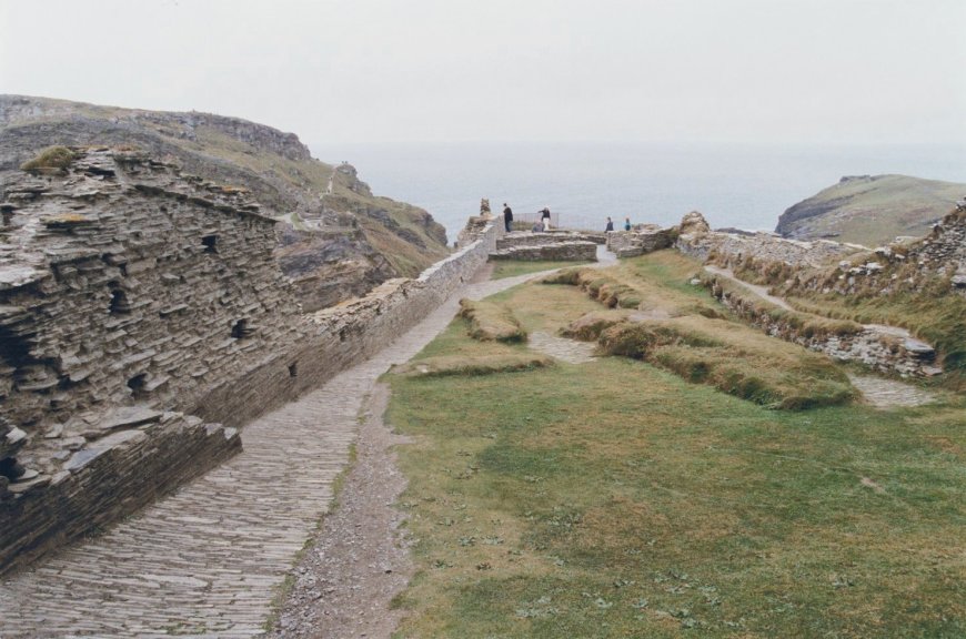
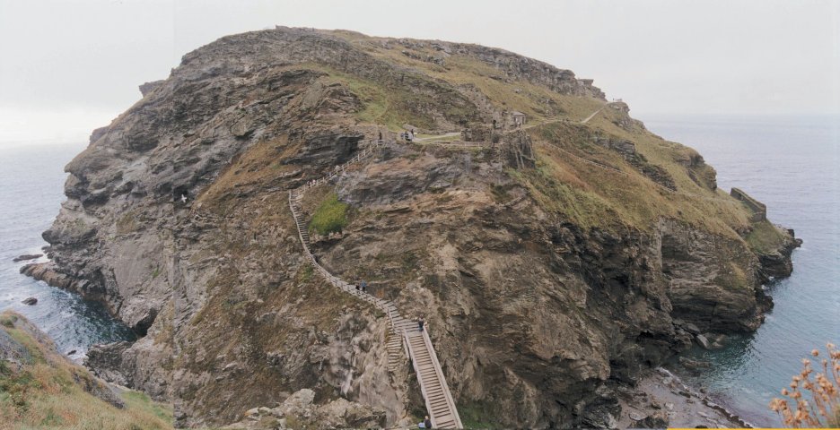
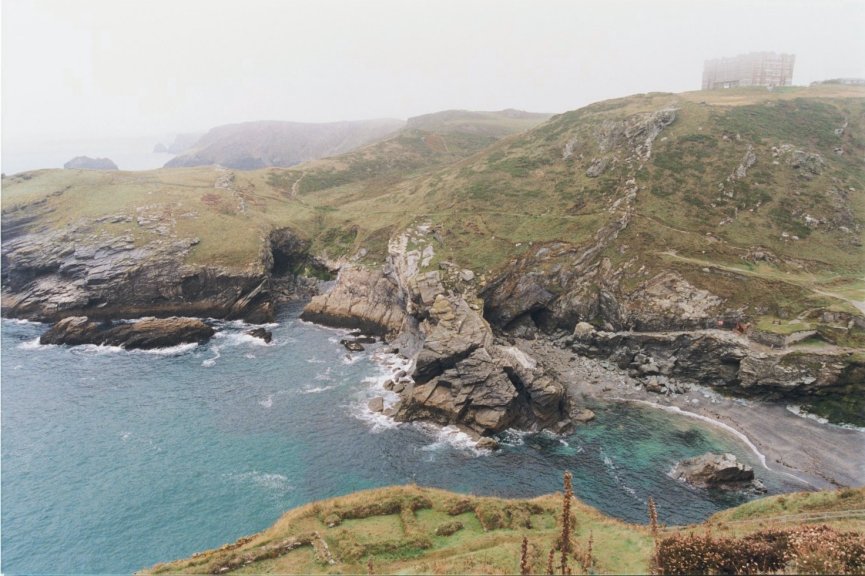
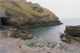
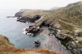
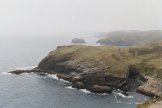
 Tintagel Island
as seen from the Lower Mainland Courtyard. A
narrow neck of land connects the
mainland and the Island. The chasm is spanned by a modern
wooden
bridge, suspended above the western inlet (left)
and eastern inlet (right), making it easier to
reach the steps leading up onto the Island. Tintagel Island
as seen from the Lower Mainland Courtyard. A
narrow neck of land connects the
mainland and the Island. The chasm is spanned by a modern
wooden
bridge, suspended above the western inlet (left)
and eastern inlet (right), making it easier to
reach the steps leading up onto the Island.
|
|
|
|
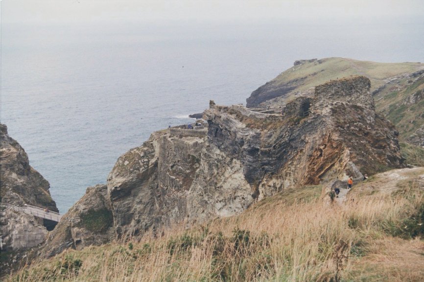
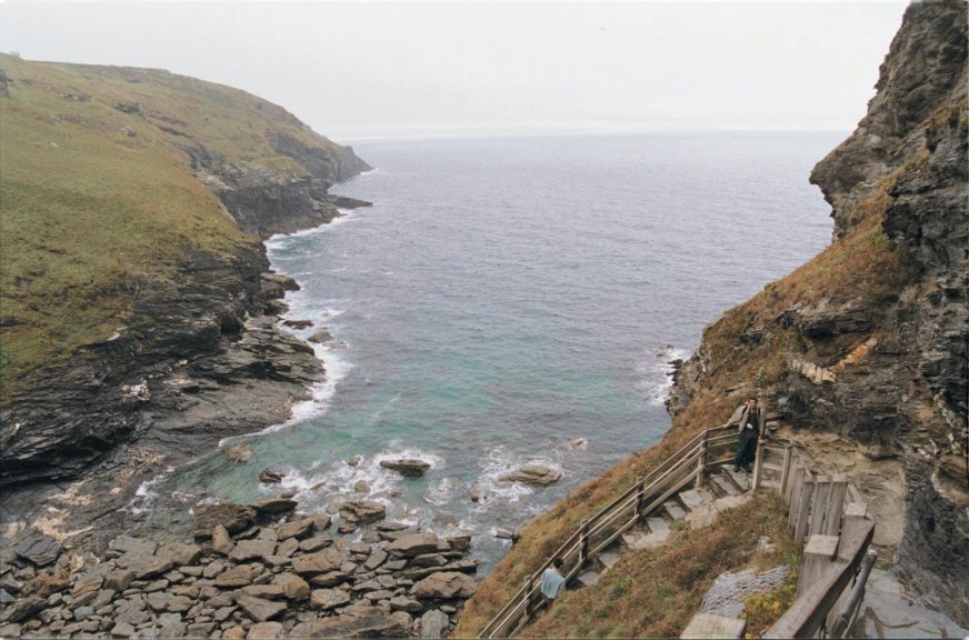
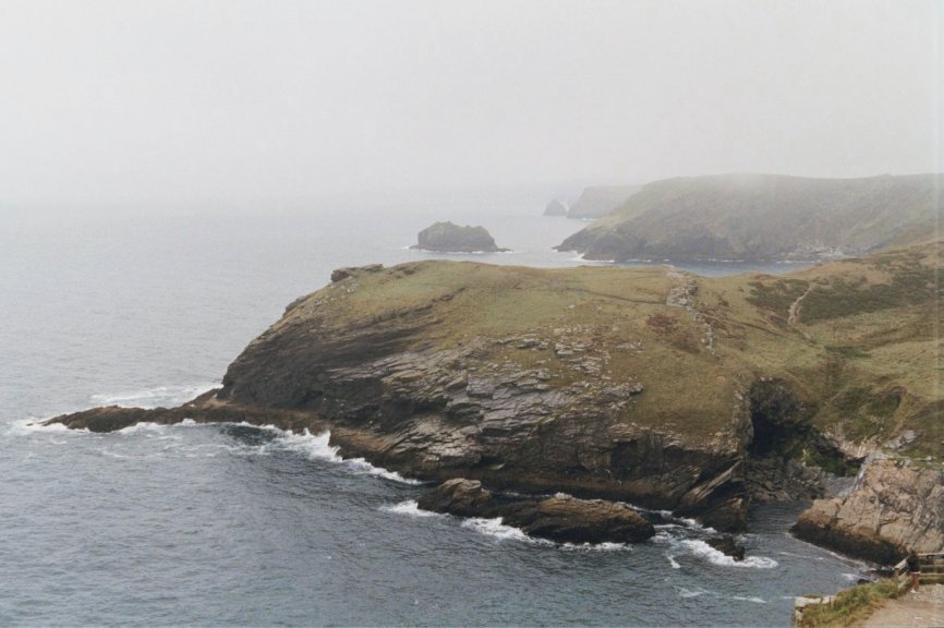
 Tintagel's
western inlet is open to the worst storms.
Crevices in the rock have been opened up by the
powerful action of the waves resulting in the many
boulders on the beach. Tintagel's
western inlet is open to the worst storms.
Crevices in the rock have been opened up by the
powerful action of the waves resulting in the many
boulders on the beach.
|
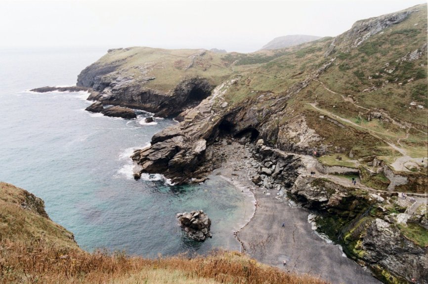
 By
contrast, the sandy eastern inlet, known
as the Haven, is much more sheltered. Roman,
Dark Age and medieval cargos were landed on the
sandy beach of the Haven. In the 19th century,
small sailing craft put out from the Haven with
cargoes of slate quarried from the cliffs. By
contrast, the sandy eastern inlet, known
as the Haven, is much more sheltered. Roman,
Dark Age and medieval cargos were landed on the
sandy beach of the Haven. In the 19th century,
small sailing craft put out from the Haven with
cargoes of slate quarried from the cliffs.
|
|
|
|
 In
the 5th and 6th centuries CE, the link between
Tintagel's mainland and the Island must have been much wider
and higher than it is today. It may have looked
more like the narrow part of Barras Nose, the
headland across the other side of the Haven,
before the sea created the present narrow neck. In
the 5th and 6th centuries CE, the link between
Tintagel's mainland and the Island must have been much wider
and higher than it is today. It may have looked
more like the narrow part of Barras Nose, the
headland across the other side of the Haven,
before the sea created the present narrow neck.
|
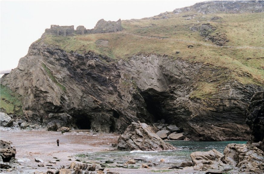
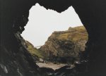
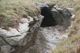
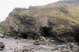 Tintagel
Castle sits above these two caves in the Haven.
A fault or a layer of weaker rocks crosses the Tintagel
Head on which the castle is built. The rocks were eroded by the sea
forming several irregular sea caves all in one row.
According to the King Arthur legend, Merlin the
magician lived in a cave below the fortress of Tintagel.
The larger of the two caves (rightmost) is known
as Merlin's Cave. In Lord Tennyson's Idylls of the
King, Merlin stood on the beach beside the cave's entrance with the infant Arthur raised high in his arms. Tintagel
Castle sits above these two caves in the Haven.
A fault or a layer of weaker rocks crosses the Tintagel
Head on which the castle is built. The rocks were eroded by the sea
forming several irregular sea caves all in one row.
According to the King Arthur legend, Merlin the
magician lived in a cave below the fortress of Tintagel.
The larger of the two caves (rightmost) is known
as Merlin's Cave. In Lord Tennyson's Idylls of the
King, Merlin stood on the beach beside the cave's entrance with the infant Arthur raised high in his arms.
|
|
|
|
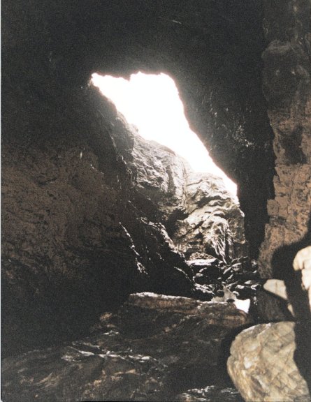
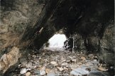 Both
caves are high enough to walk through and both penetrate through the whole head to the other
side forming tunnels beneath Tintagel Island. Both
caves are high enough to walk through and both penetrate through the whole head to the other
side forming tunnels beneath Tintagel Island.
|
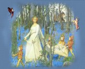
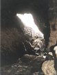 Legend
has it that inside Merlin's
Cave, Arthur was schooled in
the ways of magic and purpose of his knighthood. Legend
has it that inside Merlin's
Cave, Arthur was schooled in
the ways of magic and purpose of his knighthood.
|
|
|
|
 The
great chasm between the mainland and the Island is
spanned by a modern wooden bridge. It was built in
the 1970s to replace an earlier path and set of
steps that had become very dangerous. The
great chasm between the mainland and the Island is
spanned by a modern wooden bridge. It was built in
the 1970s to replace an earlier path and set of
steps that had become very dangerous.
|
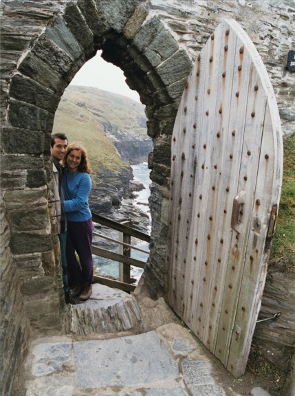
 A large doorway opens off the steep steps leading up and into
Tintagel's Island courtyard. A large doorway opens off the steep steps leading up and into
Tintagel's Island courtyard.
|
|
|
|
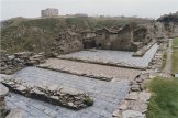
 Tintagel's
Island courtyard. This inner courtyard - the heart
of the medieval castle - was once larger. Part of
it has fallen down the cliff taking with it part
of the courtyard wall and one end of the Great
Hall built for Earl Richard in about 1235 CE. Tintagel's
Island courtyard. This inner courtyard - the heart
of the medieval castle - was once larger. Part of
it has fallen down the cliff taking with it part
of the courtyard wall and one end of the Great
Hall built for Earl Richard in about 1235 CE.
|
 The
remaining battlemented north wall of the
castle's Island courtyard. The
remaining battlemented north wall of the
castle's Island courtyard.
|
|
|
|
 The
Island courtyard as seen from the battlemented
wall in the northwest. On the cliff top
overlooking the Haven stands King Arthur's Castle
Hotel, built just before 1900. The
Island courtyard as seen from the battlemented
wall in the northwest. On the cliff top
overlooking the Haven stands King Arthur's Castle
Hotel, built just before 1900.
|
 Visible
through the crumbled remains of the Great Hall
in the Island courtyard are windows and
doorways. Visible
through the crumbled remains of the Great Hall
in the Island courtyard are windows and
doorways.
|
|
|
|
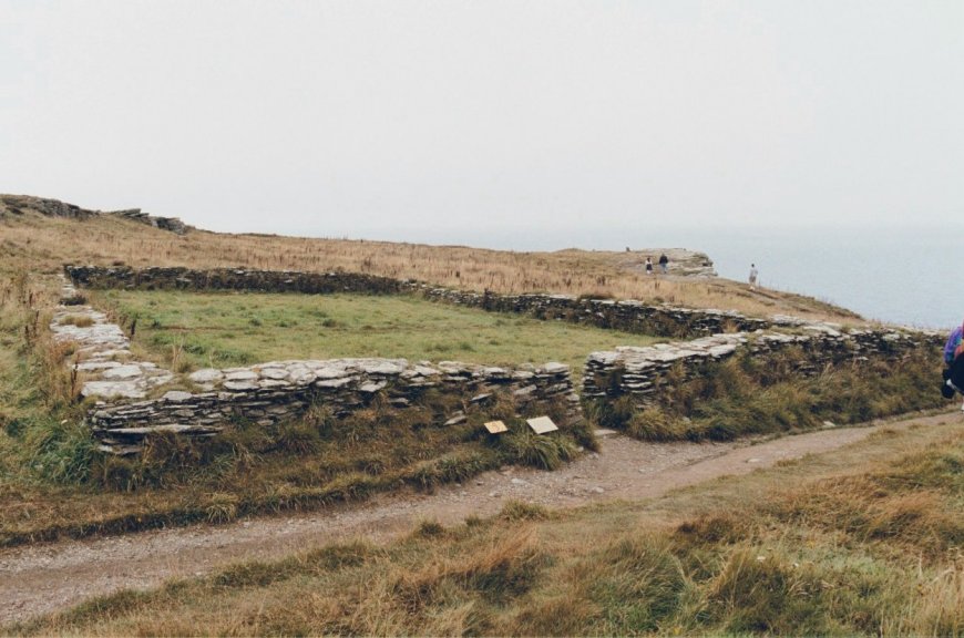
 Building
remains located in the southeast portion of the
Island courtyard. Building
remains located in the southeast portion of the
Island courtyard.
|
 The
remains of a two-roomed building with a flight of
steps up to where there was once an upper floor.
This may have been a private chamber, intended for
the use of the Earl on his rare visits to
Tintagel. The
remains of a two-roomed building with a flight of
steps up to where there was once an upper floor.
This may have been a private chamber, intended for
the use of the Earl on his rare visits to
Tintagel.
|
|
|
|
 Looking
from the Island back to the mainland, the two
halves of Tintagel castle are visible. In
the background are the two Mainland courtyards
perched on top of the sheer cliff. In the center
lies the Island courtyard with its battlemented
wall. In the foreground, along the sheltered
sloping side of the Island, are four small groups
of ruined buildings thought to be Dark Age
houses, their low walls topped with grass. Looking
from the Island back to the mainland, the two
halves of Tintagel castle are visible. In
the background are the two Mainland courtyards
perched on top of the sheer cliff. In the center
lies the Island courtyard with its battlemented
wall. In the foreground, along the sheltered
sloping side of the Island, are four small groups
of ruined buildings thought to be Dark Age
houses, their low walls topped with grass.
|
 The two
mainland courtyards and the Island courtyard as
seen from the top of the Island. In the great
cliff supporting the mainland courtyards, the
various rock strata can be seen - the hard, dark
bed of slate lying just below the mainland
courtyards and below it, the softer, pale green-gray
layers. The cliff is ridden with fissures running
up through the rock. Large pieces of the cliff
have fallen away destroying part of the castle. The two
mainland courtyards and the Island courtyard as
seen from the top of the Island. In the great
cliff supporting the mainland courtyards, the
various rock strata can be seen - the hard, dark
bed of slate lying just below the mainland
courtyards and below it, the softer, pale green-gray
layers. The cliff is ridden with fissures running
up through the rock. Large pieces of the cliff
have fallen away destroying part of the castle.
|
|
|
|
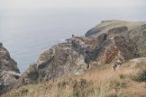
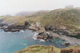
 View
of Tintagel's setting - its savage landscape of
contorted rocks, sea caves and narrow sandy inlets
- as seen from the eastern side of the Island. View
of Tintagel's setting - its savage landscape of
contorted rocks, sea caves and narrow sandy inlets
- as seen from the eastern side of the Island.
|
 Barras
Nose and one
of the groups of ruined Dark Age buildings along
the sloping eastern side of the Island.
According to the surveyors of the Royal
Commission on the Historical Monuments of
England (now a part of English
Heritage), at least 150 buildings lay
beneath the grass and heather on top of the
Island and its sheltered eastern and southern
slopes. Barras
Nose and one
of the groups of ruined Dark Age buildings along
the sloping eastern side of the Island.
According to the surveyors of the Royal
Commission on the Historical Monuments of
England (now a part of English
Heritage), at least 150 buildings lay
beneath the grass and heather on top of the
Island and its sheltered eastern and southern
slopes.
|
|
|
|
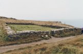 This
small walled area on the top of the Island seems
to have been laid out in the Middle Ages as a
garden. It was in walled gardens that the gentler
and more sophisticated episodes of courtly life
took place: books were read, poetry was recited,
and the latest songs were sung. This
small walled area on the top of the Island seems
to have been laid out in the Middle Ages as a
garden. It was in walled gardens that the gentler
and more sophisticated episodes of courtly life
took place: books were read, poetry was recited,
and the latest songs were sung.
|
 The
ruined buildings on the northern side of the
Island were uncovered in the 1930s. Their date
and purpose are still something of a mystery.
Some of the buildings may be as old as the 5th
or 6th century CE, like those on the eastern
slopes of the Island. Others may be medieval in
date. The
ruined buildings on the northern side of the
Island were uncovered in the 1930s. Their date
and purpose are still something of a mystery.
Some of the buildings may be as old as the 5th
or 6th century CE, like those on the eastern
slopes of the Island. Others may be medieval in
date.
|
|
|
|
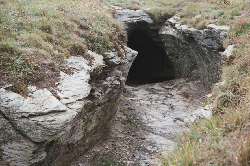
 No
one really knows for what purpose this short
length of tunnel was dug. The most likely is that
the tunnel was dug in the Middle Ages as a long
narrow larder for the castle, built this shape in
order to economize on roofing materials. The sea
wind blowing through the tunnel would keep the
food cool. No
one really knows for what purpose this short
length of tunnel was dug. The most likely is that
the tunnel was dug in the Middle Ages as a long
narrow larder for the castle, built this shape in
order to economize on roofing materials. The sea
wind blowing through the tunnel would keep the
food cool.
|
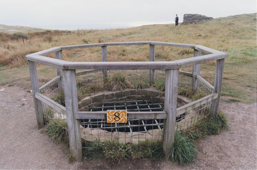
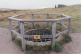 The
shallow depression on the top of the Island is
the only natural water-catchment at Tintagel.
The well is medieval in date and must have been
the main source of water for the castle apart
from any water collected from the roofs of the
buildings. The
shallow depression on the top of the Island is
the only natural water-catchment at Tintagel.
The well is medieval in date and must have been
the main source of water for the castle apart
from any water collected from the roofs of the
buildings.
|
|
|
|
 View
of Tintagel Parish Church, which has Norman and
Saxon masonry, from the southern cliffs of the Island. View
of Tintagel Parish Church, which has Norman and
Saxon masonry, from the southern cliffs of the Island.
|
 This
tiny chapel, dedicated to St Juliot, seems to
have been built around the end of the 11th
century, a time when the old Dark Age stronghold
had been long abandoned and the castle had not
been built. This
tiny chapel, dedicated to St Juliot, seems to
have been built around the end of the 11th
century, a time when the old Dark Age stronghold
had been long abandoned and the castle had not
been built.
|
|
|
|
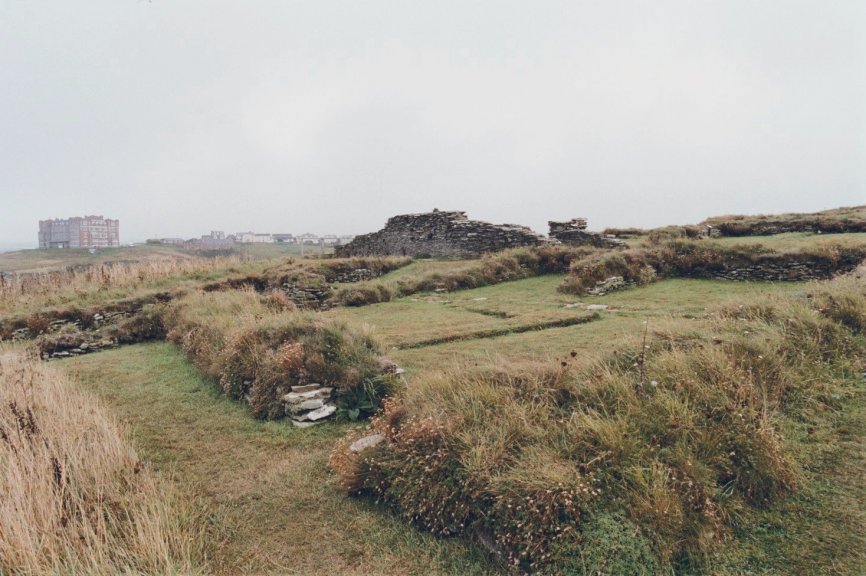
 Around
the chapel are more low stone walls topped with
grass. These are all that remain of quite a large
complex of buildings of various dates - some Dark
Age and some medieval. Around
the chapel are more low stone walls topped with
grass. These are all that remain of quite a large
complex of buildings of various dates - some Dark
Age and some medieval.
|
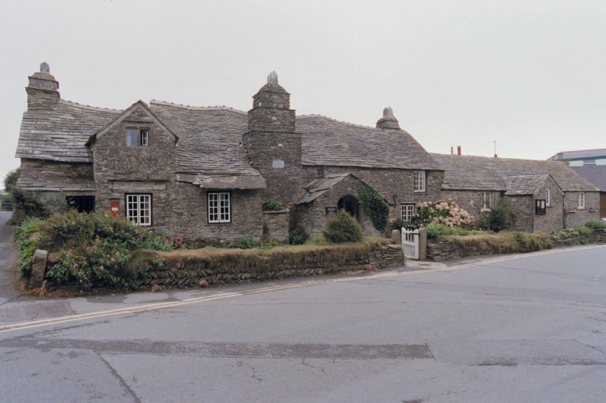
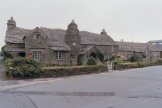 In
Tintagel Village,
the Old Post Office is a rare example of a
14th-century Cornish longhouse, beautifully
restored and furnished with 17th-century oak
furniture. In
Tintagel Village,
the Old Post Office is a rare example of a
14th-century Cornish longhouse, beautifully
restored and furnished with 17th-century oak
furniture.
|
|
|
|